Barndominium Builders in Jefferson County, MO
Start with the thing that wastes more of people's time here than anything else: this page is about Jefferson County, the charter county on the Mississippi immediately south of St. Louis County, with its seat at Hillsboro. It is not Jefferson City, which is the state capital, sits in Cole County about ninety miles west, and answers to an entirely different building department. If the land you are looking at is near Arnold, Festus, De Soto, Hillsboro, Cedar Hill, High Ridge, Imperial, Byrnes Mill or House Springs, you are in the right place. There is real acreage here — the 2022 Census of Agriculture counted 656 farms on 106,429 acres, a 162-acre average, and 36,706 of those acres are woodland, which is what the northeast corner of the Ozark Highlands looks like in a table. And unlike the county to the north, most people here live outside a city: 166,008 of the county's 231,888 residents live in the unincorporated balance, which is exactly the territory the county's own code governs. That code is real and it is enforced. Jefferson County adopted the 2015 International Residential Code, it prints its own filled-in design table with a 30-inch frost line, and its zoning puts a five-acre minimum under a dwelling in the RA-5 Rural/Agricultural District — but then allows up to 4,000 square feet of detached accessory building, or five percent of the unbuilt lot area, whichever is more permissive. Two things will decide more builds here than the code does. The first is the septic ground: the county runs its own On-Site Sewage Treatment Code, it applies to every system in unincorporated territory, it bars a conventional absorption field on slopes over 20 percent, and it wants three feet of soil between the field and bedrock — which on a cherty hillside is the whole question. The second is the Old Lead Belt: EPA's Southwest Jefferson County Mining Superfund site takes in all of Jefferson County except Herculaneum, and EPA will sample a yard for lead at no cost to the owner. For a reader comparing where to buy, the county line matters: St. Louis County to the north is another charter county with its own code, Franklin and St. Francois are first-classification counties, and Washington and Ste. Genevieve to the west and south are third-classification counties with no county building-code authority at all.
Jefferson County at a glance
- County
- Jefferson County
- Population
- 231,888
- ZIP codes
- 63010, 63012, 63016, 63019, 63020, 63023, 63028, 63047, 63048, 63049, 63050, 63051, 63052, 63053, 63070
- Site visits
- Usually the same week — the office is in Jennings, a straight run down I-55
Building conditions in Jefferson County
Missouri sets no residential building code and no statewide way of adopting one, so the first question on any parcel is not what the code says — it is whether there is one. Only counties of the first and second classification may adopt a building code at all, and classification is set by assessed valuation rather than population, so a small county can hold the power while a much larger one does not. Zoning is a separate power with its own answer, granted only after a vote of the people and repealable by another. What changes from one jurisdiction to the next is whether the work is inspected, who issues the permit, what that office charges, how the parcel is zoned, and the design figures your drawings have to satisfy.
Home Rule Charter of Jefferson County, Missouri § 1.4 (county seat), read via the county's codified ordinances on eCode360 (Jefferson County, MO, code JE3328, current through 13 July 2026) 6 September 2026; municipality list and populations from U.S. Census Bureau Vintage 2024 Subcounty Population Estimates, sub-est2024_29.csv, SUMLEV 157 records for county FIPS 29099; place classification and coordinates from the 2024 Census Gazetteer places file; straight-line distance computed from the Gazetteer internal points for Hillsboro city and Jefferson City city — both files fetched 6 September 2026
Home Rule Charter of Jefferson County, Missouri §§ 1.5 and 1.6, read via eCode360 (Jefferson County, MO, JE3328) 6 September 2026; Missouri Association of Counties, "Missouri Counties by Classification", published May 2025, CHARTER list of 5 counties, PDF read 6 September 2026; Mo. Const. Art. VI §§ 18(a) and 18(c); RSMo 64.170 catchline and text, effective 28 August 2008, rendered from revisor.mo.gov 6 September 2026
Jefferson County Code § 500.400, Article III, Amendments to the International Residential Code 2015, Table R301.2(1) as adopted (Ord. No. 11-0248 § 1(Art. III § 1), 9 August 2011; Ord. No. 13-0459, 10 December 2013; Ord. No. 17-0431, 28 September 2017; Ord. No. 23-0465, 16 November 2023), read from the rendered code on eCode360 6 September 2026
Jefferson County Code § 400.2870 (Zoning Order § 8.060, 2 April 2008; Ord. No. 07-30-2008A §§ 1–2(8.060), 30 July 2008), § 400.1470, § 400.1660 Table 5-2 and § 400.1670 Table 5-3 (Ord. No. 16-0100 § 2, 4 January 2016), read from the rendered Unified Development Order on eCode360 6 September 2026
Jefferson County Code §§ 705.010, 705.020(A), 705.170, 705.180 and 705.210 (Ord. No. 11-0248 § 1, 9 August 2011), and § 500.130 On-Site Sewer System Designer License, read from the rendered code on eCode360 6 September 2026; RSMo 701.031 and 701.047 as recorded in research/statewide/code-regime.md § 7a
U.S. EPA Superfund Site Profile, SOUTHWEST JEFFERSON COUNTY MINING, Jefferson County, MO — Cleanup Activities page (cumulis.epa.gov, site id 0705443), fetched and read 6 September 2026; U.S. EPA Region 7, "Superfund National Priorities List (NPL) Sites Near Big River and Floodplain; St. Francois, Jefferson, and Washington Counties, Missouri – Fact Sheet, September 2021" (epa.gov/mo), fetched 6 September 2026
Also worth knowing before you build in Jefferson County
- Karst is not this county's problem — 54 mapped sinkholes against 1,474 next door
- The reflex about the Ozark border is sinkholes, and here the data says otherwise. Missouri's Department of Natural Resources publishes a statewide layer of known and probable sinkhole locations holding 16,001 points, which matches the roughly 16,000 the department publishes in prose. Queried against the county boundary, 54 of those points fall inside Jefferson County. St. Louis County, immediately north and far more built up, holds 1,474; Greene County around Springfield holds 1,471; St. Francois County to the south holds 133. What shapes a foundation here is slope and shallow rock on wooded hillsides, not solution cavities — which is why the county's own septic code writes rules about 20 percent slopes and three feet of soil above bedrock rather than about sinkhole setbacks.
- New flood maps took effect in October 2025, and the county rewrote its ordinance for them
- Jefferson County repealed its entire Flood Damage Prevention chapter and replaced it on 4 December 2025. The new chapter runs against a Flood Insurance Study for Jefferson County dated 2 October 2025 and Flood Insurance Rate Map index panels 29099CIND1C and 29099CIND2C of the same date, and it requires a separate floodplain development permit for any development in a mapped A, AE, AO or AH zone. It also draws the line a barndominium buyer needs to see: a structure used solely for agricultural purposes may be built at grade and wet-floodproofed only where "there is no human habitation or occupancy of the structure," it is of single-wall design, and a floodplain development permit has been issued — and even then a variance is required whenever the lowest floor is at grade below the base flood elevation. A house on a farm is not an agricultural structure.
- A driveway onto a county road is its own permit, with a refundable escrow
- Since 26 November 2024 anyone building, modifying or reconstructing a private driveway entrance onto a county-maintained road in unincorporated Jefferson County has to apply to the Department of Public Works for a permit. The escrow is set by driveway type: $500.00 for a single-lot residential entrance 12 to 28 feet wide, $500.00 for an agricultural gravel entrance 16 to 40 feet wide, $1,000.00 for a residential subdivision entrance and $1,500.00 for a commercial or industrial one. The county cashes the escrow and holds it as a bond, keeps whatever it needs to repair damage in the right-of-way, and returns the balance when the entrance is accepted. Design standards start with a 125-foot minimum offset, centre to centre, from any other entrance or intersection on the same side of the road — which on a narrow-frontage parcel can decide where the driveway goes before the house is sited.
- The county licenses the trades, and tests homeowners who want to do their own
- There is no general or building contractor licence in Jefferson County. What Chapter 500 licenses is plumbing, electrical, mechanical, communications, sprinkler fitting, lawn irrigation installation, on-site sewer system installation, on-site sewer system design and on-site soil evaluation — the trades, not the builder. The plumbing licence provision goes further than most and reaches advertising: no contractor may perform plumbing work "or hold itself out in any advertising medium or publication as being available to perform plumbing work" without it. A property owner may take out a permit to do electrical, plumbing, mechanical or drainlaying work on their own detached single-family dwelling, but only if they occupy it, personally perform all the work, hold no other open permit, and pass a written examination at 75 percent or better; two failures and the applicant waits a year.
- The permit fee is priced off the county's own square-foot valuation
- Jefferson County does not ask what your builder charged. Section 500.250 sets the minimum cost of construction the county will use to calculate a permit fee — $120.00 per square foot for new residential work, $38.00 per square foot for utility buildings, $165.00 for residential remodelling and $65.00 for a finished basement — and then reads the fee off a bracketed table. A build valued between $300,001 and $320,000 draws a $1,725.00 building permit fee. Residential plan review is $40.00 per submittal and each revision, the planning and zoning fee is $10.00, the processing fee is $25.00, and an inspection or re-inspection is $50.00. The split between the $120.00 and the $38.00 rate is worth reading twice on a shop-and-house: the county prices the two halves of the building differently.
- The sprinkler offer is a submittal document here
- Missouri does not let any city or county make residential fire sprinklers mandatory in a new one- or two-family dwelling, but it does require the builder to offer them at the purchaser's cost before the purchase contract is signed. Jefferson County turns that state duty into a piece of paper the building department will not proceed without: its amendment to IRC R106.1 provides that submittal documents shall include the form, signed by the purchaser of a single-family dwelling or a multi-unit dwelling of four or fewer units, stating that the option was offered. The same amendment requires construction documents for a new one- or two-family dwelling to carry the name and contact information of whoever prepared them.
- The Charter makes the county review its own codes every three years
- Missouri imposes no currency requirement on an adopting county — RSMo 64.196 asks only for a nationally recognised code of 1999 or later, with no review cycle and no state approval. Jefferson County imposed one on itself. Charter § 6.3.1.3 requires the Code Commission to review all building codes and related ordinances whenever the underlying model code is revised, "but in any event once every three years," and to propose any modification or repeal it thinks necessary, after making a finding on the public benefits and on the costs of enforcement and compliance "including increases in costs of construction." A review is not an adoption: the county has run the 2015 editions since it moved to them, and the codes it adopted in 2011 are still the frame. But it is a rare thing in this state for the question to be on a calendar at all.
- 656 farms, 106,429 acres, and a third of it woodland
- The 2022 Census of Agriculture counted 656 farms in Jefferson County on 106,429 acres, an average holding of 162 acres, in a county with 656.264 square miles of land. Of that land in farms, 38,891 acres are cropland, 25,366 acres pastureland and 36,706 acres woodland — better than a third of it wooded, which is the Ozark Highlands showing up in a table. The size distribution is what a buyer actually wants: 60 farms are between one and nine acres, 221 between ten and forty-nine and 245 between fifty and 179, so roughly four in five holdings here are under 180 acres. Land in farms rose 17 percent between 2017 and 2022 while the number of farms fell 9 percent, which is consolidation rather than the subdivision happening in the county to the north.
- Two of the counties on this one's border cannot have a building code at all
- Jefferson County touches six others — St. Louis County to the north, Franklin to the northwest, Washington to the west, St. Francois to the southwest, Ste. Genevieve to the south, and Monroe County, Illinois across the Mississippi. Under the classification list published by the Missouri Association of Counties in May 2025, St. Louis County is the other charter county, Franklin and St. Francois are first-classification counties, and Washington and Ste. Genevieve are third-classification counties. That last word is the one that changes an answer: RSMo 64.170 empowers only counties of the first and second classification to adopt a building code, so a third-classification county has no county building-code authority whatsoever, and no county building department is going to inspect the work. Crossing this county's southern or western line can therefore change not just the code but whether there is one.
- The Big River carries the Old Lead Belt into the Meramec here
- The Missouri Department of Conservation puts the Meramec basin in "the northeast corner of the Ozark Highlands," draining 2,149 square miles across ten counties including this one, with base flows sustained by springs and by two major tributaries — the Bourbeuse, which enters at river mile 64.0, and the Big River, which enters at river mile 35.7. That second confluence is the one that matters here: EPA describes the Big River as running through the Old Lead Belt and carrying mine waste downstream onto the floodplain, and it has made the Big River and its floodplain a distinct operable unit of the Superfund site that covers this county. So the two facts a buyer needs about water here — the Meramec draining a wooded Ozark watershed, and the Big River arriving from the lead district — are the same river system.
- The corrugated-steel ban in this county's code is a data-centre rule, and it stops there
- Jefferson County's Unified Development Order does carry a prohibited-materials list, and corrugated steel is the first item on it, so it is worth being exact about what that list reaches. Section 400.3700(N)(1) provides that buildings and accessory structures "shall not include the following as primary building materials or architectural finish: a. Corrugated steel. b. Smooth finish concrete block (cinder block). c. Smooth finish poured concrete, whether painted or unpainted. d. Vertical rough-sawn wood siding (T-111/T-19). e. Tensile fabrics. f. Single layer uninsulated materials." That section sits inside Article X, Data Center Regulations And Performance Standards, added by Ordinance No. 26-0203 on 27 April 2026, and the article states its own reach one section earlier: Section 400.3670(A) says "These standards apply to all Data Centers, whether principal or accessory use." It does not touch a dwelling. The design-standards article says the same thing from the other direction. Section 400.2170(C) applies those standards to all zoning districts "with the exception of the 'RA-5' Rural/Agricultural District", which is the district almost all rural acreage in the county sits in, and Section 400.2200 sends the rural and rural-cluster patterns back to the RA-5 district standards, which govern density, lot size, setbacks and height and say nothing about what a building is clad in. The suburban and mixed-use residential design standards at Sections 400.2250 and 400.2310 are street layout, sidewalk and lot-access rules. Nowhere in the Order is there a minimum roof pitch on a house, a minimum eave projection, a minimum masonry percentage or a minimum dwelling floor area, and the four-sided-architecture clause at Section 400.2320(A)(3)(c) is a transition standard between residential and non-residential uses in the mixed-use pattern, written as "similar architectural details, materials and colors" rather than as a material list. Chapter 500, which adopts the residential code and amends it at length, carries no exterior-covering provision either. Appearance review exists in one place: the determination of appropriateness at Section 400.2020, required before construction affecting a designated landmark or a property inside a nominated or designated historic district. Inside their own limits the county's municipalities answer for themselves.
Missouri Department of Natural Resources / Missouri Office of Geospatial Information SINKHOLES layer, gis.dnr.mo.gov/host/rest/services/geology/sinkholes/MapServer layer 1, queried 6 September 2026 with a spatial-intersect count against the county polygon returned by the U.S. Census Bureau TIGERweb State_County service for GEOID 29099; the same query returns 16,001 statewide, corroborating the department's published figure on dnr.mo.gov/land-geology/hazards/sinkholes
Jefferson County Code ch. 405, Flood Damage Prevention, §§ 405.010, 405.020, 405.040(A) and 405.060 (Ord. No. 25-0406, 4 December 2025, repealing former ch. 405; prior history Ord. Nos. 10-0221, 19-0289, 22-0116 and 25-0339), read from the rendered code on eCode360 6 September 2026
Jefferson County Code §§ 515.010, 515.030, 515.040 (Table 1) and 515.050 (Ord. No. 24-0439, 26 November 2024), read from the rendered code on eCode360 6 September 2026
Jefferson County Code §§ 500.070 through 500.180 (trade licences), § 500.070(F) (advertising), and § 500.190 Homeowner Permits (Ord. No. 11-0248 § 1(Art. I §§ 7–19), 9 August 2011; § 500.070 as amended by Ord. No. 23-0465, 16 November 2023), read from the rendered code on eCode360 6 September 2026
Jefferson County Code § 500.250 Fee Schedule (Ord. No. 11-0248 § 1(Art. I § 25), 9 August 2011; Ord. No. 13-0459 § 1, 10 December 2013; Ord. No. 21-0356, 29 July 2021), read from the rendered code on eCode360 6 September 2026
Jefferson County Code § 500.400, amendments to IRC 2015 R106.1 and R106.1.1 (Ord. No. 11-0248 § 1(Art. III § 1), 9 August 2011, as amended through Ord. No. 23-0465, 16 November 2023), read from the rendered code on eCode360 6 September 2026; the state duty and the bar on mandatory sprinklers is RSMo 67.281, effective 28 August 2016, as recorded in research/statewide/code-regime.md § 2g
Home Rule Charter of Jefferson County, Missouri §§ 6.3.1.3, 6.3.1.4 and 6.3.1.5, read via eCode360 (Jefferson County, MO, JE3328) 6 September 2026; RSMo 64.196, effective 28 August 2013, as recorded in research/statewide/code-regime.md § 3c
USDA NASS 2022 Census of Agriculture, County Profile — Jefferson County, Missouri (cp29099.pdf), downloaded and text-extracted 6 September 2026; county land area from the 2024 Census Gazetteer counties file (ALAND_SQMI 656.264 for GEOID 29099), fetched 6 September 2026
U.S. Census Bureau county adjacency file (county_adjacency.txt), fetched 6 September 2026; Missouri Association of Counties, "Missouri Counties by Classification", published May 2025 — CHARTER (5), CLASS 1 (13, including Franklin and St. Francois) and CLASS 3 (89, including Washington and Ste. Genevieve), PDF read 6 September 2026; RSMo 64.170 subsection 1 and RSMo 64.205, as recorded in research/statewide/code-regime.md § 3a
Missouri Department of Conservation, Watershed Inventory — Meramec River (mdc.mo.gov/your-property/watershed-inventory/meramec-river), fetched and read 6 September 2026; U.S. EPA Region 7 fact sheet, September 2021, and the EPA Superfund Site Profile for SOUTHWEST JEFFERSON COUNTY MINING (OU-4, Big River and floodplain), both fetched 6 September 2026
Jefferson County, Missouri, County Code Chapter 400 Unified Development Order — Sections 400.1470, 400.2020, 400.2170, 400.2200, 400.2250, 400.2310, 400.2320, 400.3670 and 400.3700 (the last two from Ord. No. 26-0203, 27 April 2026) — and Chapter 500 Building Code, both rendered in full from the codified text on eCode360, custId JE3328, on 9 September 2026, the code's own currency line reading "Includes legislation through 07-13-2026"; the jurisdiction was confirmed from the page title returned in the same response as the text, and the two load-bearing passages were re-read from a separately fetched Title IV document titled "Land Use - Jefferson County, MO", which reproduced both word for word; a bogus id on the same host returns an honest 404 at 8,114 bytes
The expensive surprises are in the ground, not the building
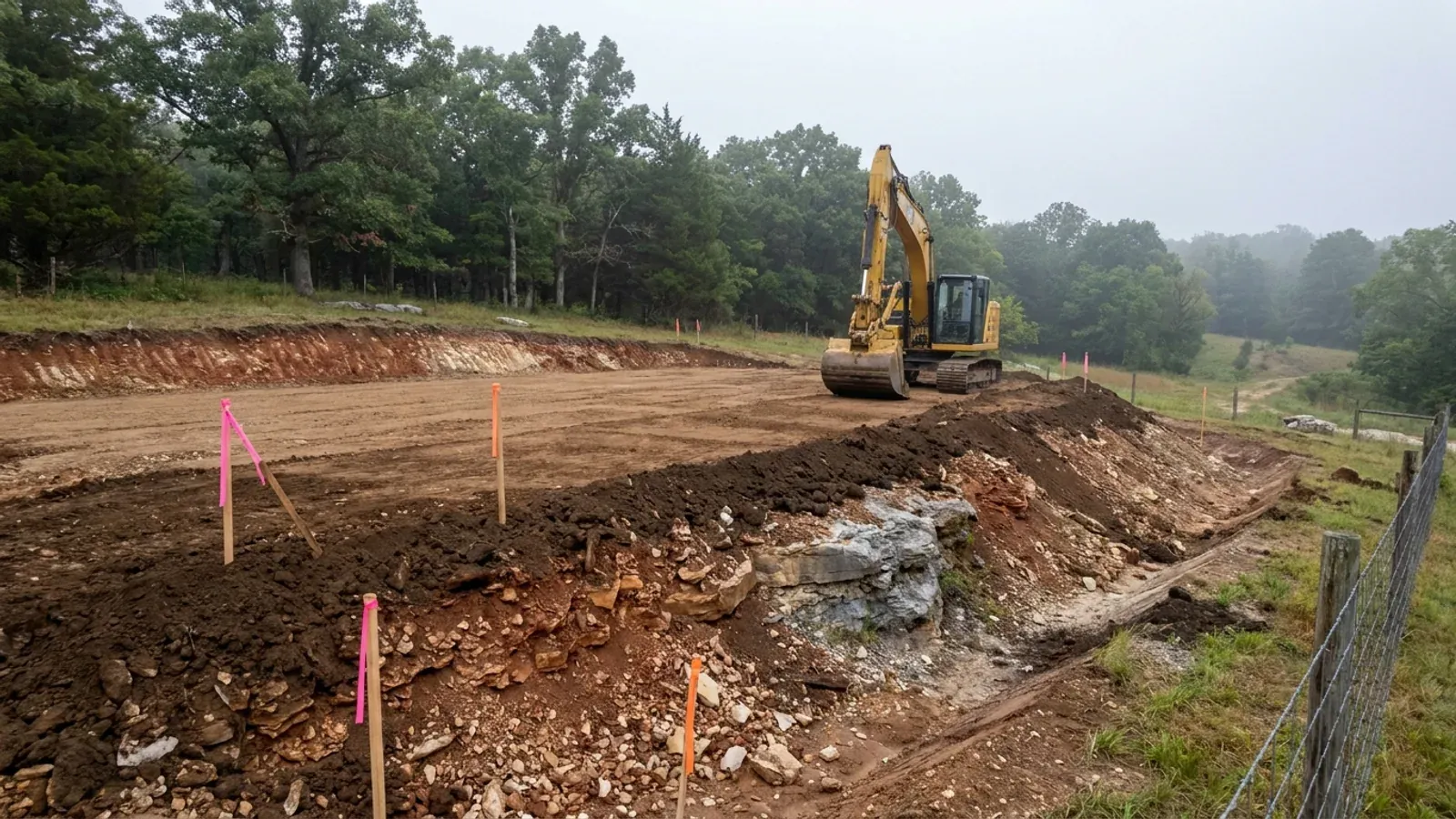
What moves a Missouri budget is usually below grade, and which problem you have depends on where in the state you are. Across the Ozarks it is karst: the Department of Natural Resources maps more than sixteen thousand sinkhole points, and what matters there is what is under the slab rather than what the slab sits in. Across the north and centre it is claypan — dense, slow-draining subsoil that perches water above it for months of the year. In the Bootheel it is deep alluvium carrying the highest seismic demand in the state, where the same soils modelled for liquefaction attack post embedment and slab bearing rather than the frame above them. The same ground then decides the septic system, and Missouri does not run that on a percolation test alone: the rule allows a perc test or a soil morphology examination in a profile pit, and the authority reviewing your parcel picks which. Where a drainfield sits near a sinkhole's drainage, perc testing on its own is not permitted at all. Whether that authority is the state or your own county is itself a local question, and it changes what you have to file. So the site work, the foundation and the drainfield get resolved together rather than one at a time. We price the dirt before we price the building.
What we build in Jefferson County
All nine services are available in Jefferson County. What a build costs depends far more on the parcel than on square footage, so we price against your land rather than publishing a rate card.
Custom Plans
Barndominium floor plans drawn to your parcel and your soil, and to whichever Missouri authority — a county, a city, or none at all — will review them.
Barndominium Kits
Barndominium shell packages delivered to your Missouri land, drawn to the criteria your own county or city publishes — because the state publishes none.
Turnkey Builds
Start to finish barndominium construction in Missouri: the permits that genuinely apply, site work, shell and interior finish, under one contract.
What a build looks like
Three stages every Jefferson County project passes through, from a raw parcel to a finished home. Site work first, because that is where the budget is decided.
The parcel
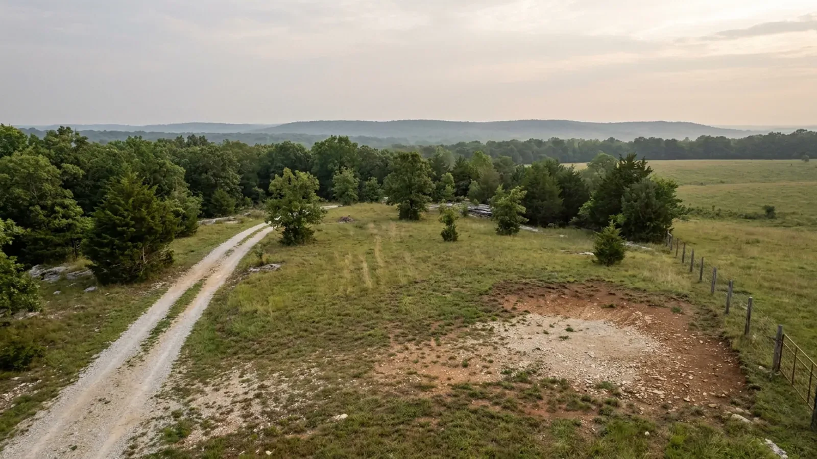
Zoning, setbacks, flood zone and utility access get checked before anything is drawn.
Pad and permit
Clearing, grading and a compacted pad, while the submittal works through whichever office issues the permit where you are building.
Frame to finish
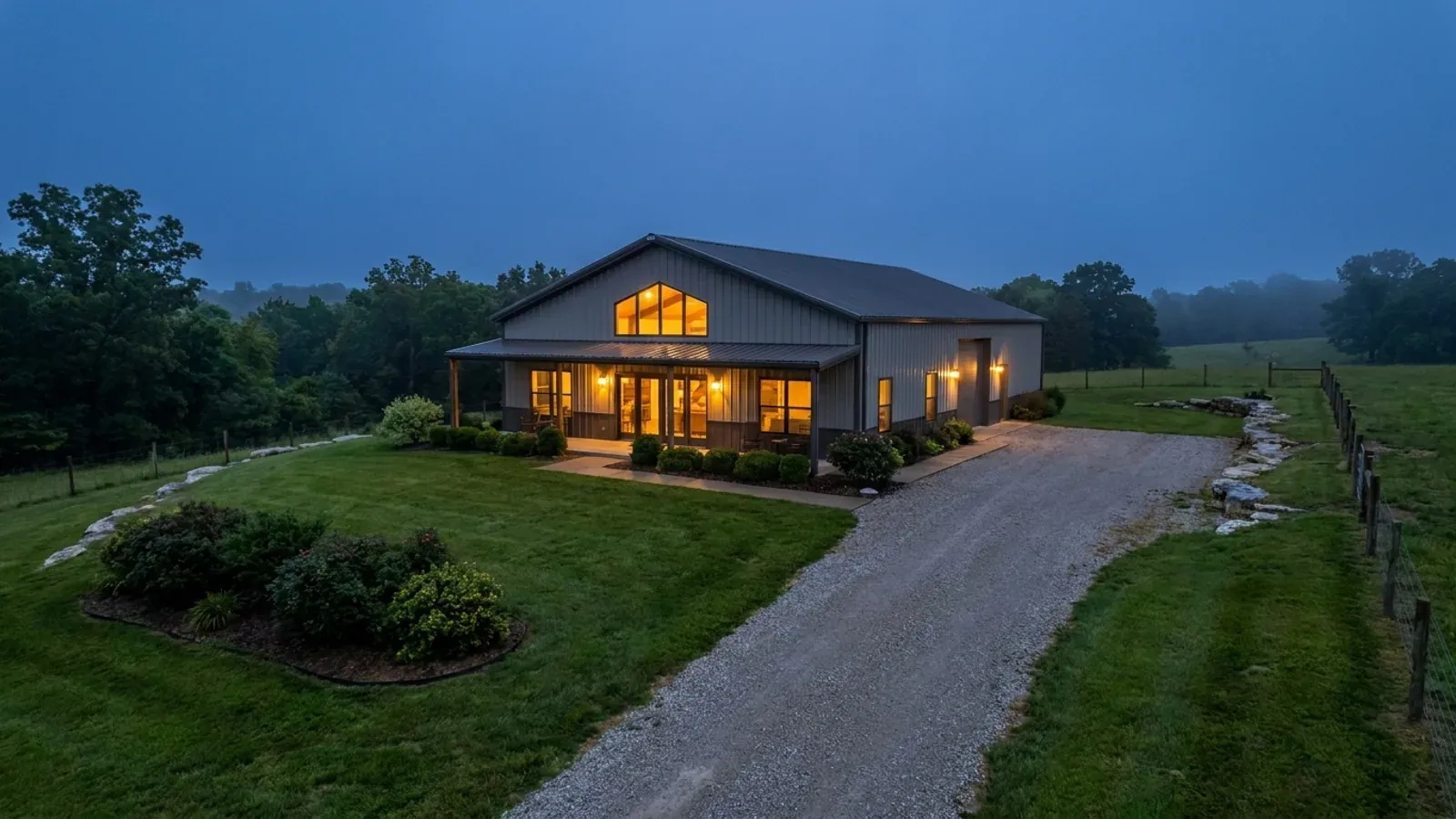
Shell erected and dried in, then systems, insulation and interior finish through to CO.
Those are the rules where you are building in Jefferson County. Tell us what you want to build and we will draw it to them.
Where we build around Jefferson County
Jefferson County and the rural land around it. The buildable acreage for a project this size usually sits outside the city limits, which is frequently what changes who issues your permit.
Keep reading
The questions that usually come next once you know what Jefferson County allows.
Barndominium Cost Guide
Sourced per-square-foot ranges by tier and by size, with a calculator built on the same figures.
Read itIs It Legal in Missouri?
Classification, zoning, the HOA gate, and why "nonresidential farm building" does not cover a home.
Read itHow Long Does It Take?
Census build-duration data, and what actually sets the permit clock where you are building.
Read itNearby areas we build in
Others we cover nearby, and they are not interchangeable. One may be a county with an adopted building code, another a county with no legal authority to have one, another a city that permits inside its own limits whichever county the land sits in. So the office that issues the permit, whether anyone inspects the work at all, the fees, the zoning and the design figures can differ from one card to the next — sometimes across a single property line.
Building in Jefferson County: common questions
9 questions we get asked most often about building in Jefferson County. If yours is not on the list, ask it directly.
Is this the same as Jefferson City?
Is there a building code here, and who inspects?
Can I put up a separate shop building next to the house?
How much land do I need, and where does the building have to sit?
My lot is over three acres — do I still need a septic permit?
The land I like is a wooded hillside. Will it perc?
The county says seismic design category C, but I have seen D. Which governs?
What is the Superfund listing about — is my land contaminated?
Do I need a licensed contractor to build here?
Building in Jefferson County?
Start with the plan. Tell us what you want to build and we will draw it, then confirm which office issues the permit for your parcel, what it will let you put there, and what wind load it has to meet. That conversation costs nothing.